Authority:
(Naegeli) Cleve-Euler.
References:
Krammer K. & Lange-Bertalot H. (1997): "Susswaserflora von Mitteleuropa", Vol.1, fig.108-9,10, p.287; Patric R. & Ch.W. Reimer (1966):"The diatoms of the United States", Vol.1, p.413,414; Podzorski A.C. (1985): "An illustrated and annotatet chack-list of diatoms from the Black River Waterways, St. Elizabet, Jamaica", Pl. 9, fig.2,3; Gasse F. (1986):"East African diatoms", Pl. XIII, fig.5
Synonyms:
Navicula oblongella (Naegeli in Kutzing 1849), Diploneis ovalis var. oblongella ((Naegeli) Cleve 1894), Pinularia ovalis (Hilse 1860), Diploneis ovalis (Hilse 1891)
Ecological Preference:
Brackish
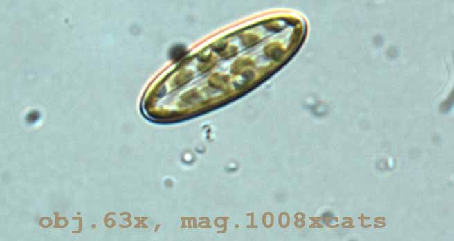
Description:
Valve is linear-elliptical to broadly elliptical with rounded ends; central area is rounded, sometimes 1/3 to 1/4 the breadth of the valve; longitudinal canals are narrow, sometimes a little broader about the central area; single row of pores (13-20 in 10µm) are present (usually so placed so as to appear as continuation of alveoli); transverse costae (10-19 in 10µm) are radiate throughout the valve, with single row of alveoli in between costae; length is 10-100µm, breadth 6-35µm
Notes:
some specimens recorded have been slightly smaller in breadth than type
Projects:
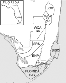
Southeast Florida Coastal Mangroves
Florida Bay Paleo Project
Dosing Project
CERP
Transect Project